DR1 Aerial Ltd is a leading provider of stockpile measurements using drones. Our innovative and efficient approach to stockpile surveys allows businesses to accurately measure, calculate and monitor the volume of materials in their stockpiles.
With the use of advanced drone technology, we are able to provide detailed and accurate stockpile measurements in a fraction of the time it takes with traditional survey methods. Our team of experienced drone pilots are able to collect high-resolution aerial images of stockpiles which are then processed using cutting-edge software to generate precise digital models. By employing photogrammetry techniques, we are able to create highly detailed 3D models that accurately represent the shape and dimensions of the stockpiles in question.

One of the key advantages of using drones for volumetric surveys is the speed and efficiency in which we can collect data. Traditional survey methods often involve manual measurements and ground-based equipment, which can be time-consuming and labour-intensive. Our drones can quickly and easily capture aerial images of stockpiles from multiple angles, allowing us to gather data in a fraction of the time.
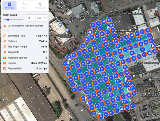
Accuracy is another crucial aspect of stockpile measurements, and our drones are equipped with high-resolution cameras that capture detailed images with exceptional clarity. Combined with the accurate control and check points we establish, this ensures that our volumetric surveys are highly accurate to 50mm or less in all axis, allowing us to provide businesses with reliable data for inventory management, resource planning, and financial reporting.
In addition to accuracy and efficiency, our drone-based stockpile surveys offer significant cost savings compared to traditional methods. By eliminating the need for expensive ground-based equipment and reducing labour requirements, our clients can save both time and money.

At DR1 Aerial Ltd, we understand the importance of accurate stockpile measurements for businesses in various industries such as construction, quarries, and logistics. Our drone-based stockpile surveys provide a cost-effective and efficient solution for businesses looking to streamline their inventory management processes. With our state-of-the-art technology and experienced team, we are committed to delivering highly accurate and reliable volumetric surveys to support our clients’ success. Please get in touch with us to discuss your project further and explore the possibilities of our drone stockpile services.