DR1 Aerial Ltd are proud to offer drone topographical surveys as part of our comprehensive range of services, providing a much faster method of accurate data collection at a lower cost.
Traditional land surveying methods often require significant time and resources, as well as potential safety risks for surveyors, however, with the advancements of aerial technology, surveys have become much more streamlined and cost-effective. Drone surveying involves the use of drones equipped with high-resolution cameras and sensors to capture detailed imagery and data of a particular area. This data can then be processed using specialised software to create accurate topographic maps and models.
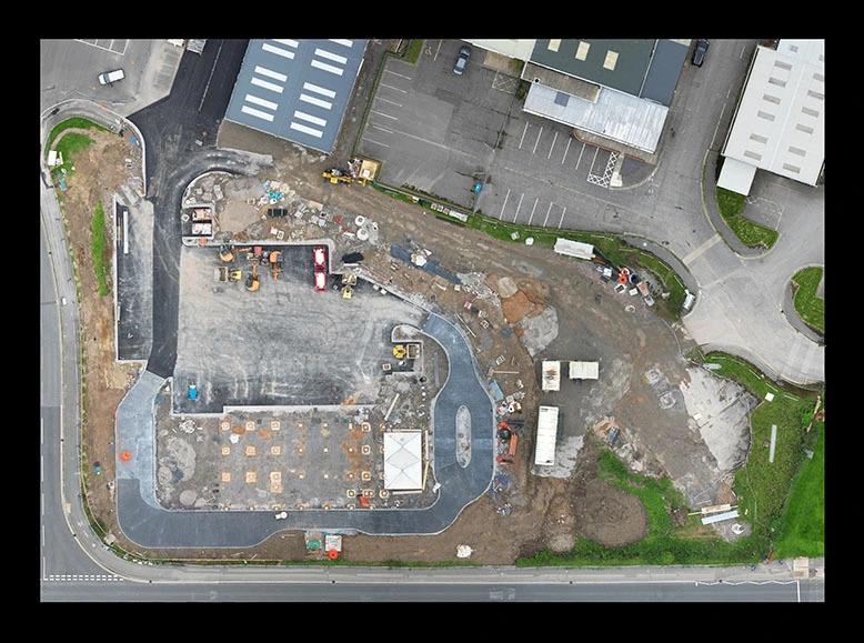
One of the major advantages of drone topographical surveys is their ability to cover large areas quickly and efficiently. Our drones can travel hundreds of acres in a single flight, capturing high-resolution imagery and collecting data points at a fraction of the time. This makes drone surveying much more cost-effective when compared to traditional methods, with current practices requiring extensive manpower, equipment, and time investment. Our drone surveys can be conducted by a single operator which not only saves time, but significantly reduces costs associated with labour, maintenance, and project duration.
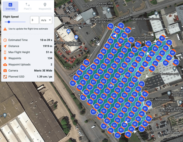
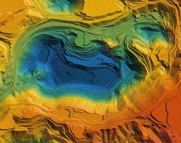
Additionally, drone topographical surveys produce highly accurate and detailed data. The high-resolution cameras and sensors on our drones, combined with accurate control and check points, enable us to create detailed topographic maps and models. DR1 Aerial are able to produce survey data with an accuracy of 50mm or less in all axis, which is crucial for various industries and applications such as urban planning, construction, mining, and environmental monitoring.

The use of drones for topographic surveys also allows for better data visualisation and analysis. DR1 Aerial Ltd can process the data using our specialised software to create 3D models, contour maps, and other representations of the surveyed area. These visualisations provide valuable insights for decision-making processes in various industries.

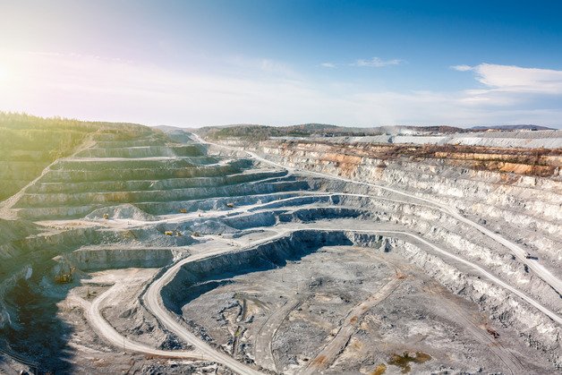
Furthermore, drone surveying enhances safety in the field. Surveyors often encounter hazardous terrain or difficult-to-reach areas during traditional surveys, especially in quarries or forestry. By using DR1 Aerial, these risks are minimised as drones eliminate the need for anyone to physically enter potentially dangerous environments once control points are established.
In conclusion, drone topographical surveys have transformed the field of surveying by offering efficient, cost-effective, and accurate data collection methods. The use of drones enables DR1 to cover large areas quickly while minimising safety risks. The highly detailed data collected through drone surveys allows for better analysis and visualisation, benefiting industries such as construction, quarries, urban planning, and environmental monitoring. Please get in touch with us to discuss your project further and explore the possibilities of our drone topographic survey services.